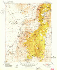
1950 Map of Paradise Peak
USGS Topo · Published 1950About this map
Brucite and the adjacent settlement of Gabbs serve as the industrial anchors of this Nevada landscape at mid-century, defined by a complex network of magnesite and tungsten extraction. The topography reveals the high-desert transition from the flat Lodi Valley to the steep ridges of the Toiyabe National Forest, where mining activity reaches into the mountains at the Paradise Mine and the Victory Tungsten Mine. Evidence of earlier eras persists at Downeyville and Craig Station, while the Gabbs Airport and its nearby Beacon indicate the growing importance of aviation for these remote mining districts. Water sources remain critical to survival and industry, marked by a string of springs such as Antelope Spring and Timber Spr that dot the slopes surrounding Paradise Peak.
Find a feature on this map
46 named features on this map. Tap any name to fly to it.
Don’t see what you’re looking for? This feature index may not catch every label — zoom into the map to look around manually.
Map Details
Editions of this 1950 Paradise Peak Map
This is the sole edition of this map. No revisions or reprints were ever made.
Other maps of this area

1907 · Tonopah
USGS Topo · 1:250,000

1908 · Tonopah
USGS Topo · 1:250,000

1908 · Carson Sink
USGS Topo · 1:250,000

1909 · Hawthorne
USGS Topo · 1:250,000

1910 · Carson Sink
USGS Topo · 1:250,000

1911 · Hawthorne
USGS Topo · 1:250,000

1915 · Hawthorne
USGS Topo · 1:250,000
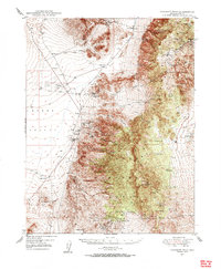
1948 · Paradise Peak
USGS Topo · 1:62,500

1948 · Walker Lake
USGS Topo · 1:250,000
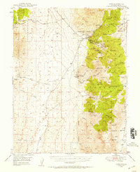
1948 · Ione
USGS Topo · 1:62,500