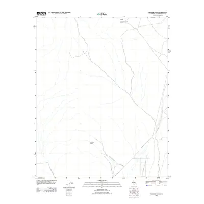
2012 Map of Paradise Range
USGS Topo · Published 2012About this map
The Venus Goldstone Deep Space Communications Complex stands as a focal point of technological infrastructure in this remote section of the Mojave Desert. Situated in northern San Bernardino County, the area is dominated by the topography of the Paradise Range, where the arid landscape is occasionally broken by features like Jack Spring. The transportation network reveals the specialized nature of the region, with routes like Camp Irwin Rd and Paradise Springs Rd connecting through the desert flats. A small cluster of residential or operational roads, including Altair Rd and Dusty Ln, lies along Paradise View Rd, indicating a pocket of human activity within the larger expanse. The presence of Rocking K Ranch Rd suggests the historical or contemporary intersection of private holdings and federal communications facilities in this high-desert environment.
Find a feature on this map
12 named features on this map. Tap any name to fly to it.
Don’t see what you’re looking for? This feature index may not catch every label — zoom into the map to look around manually.
Map Details
Editions of this 2012 Paradise Range Map
This is the sole edition of this map. No revisions or reprints were ever made.
Other maps of this area

1933 · Avawatz Mountains
USGS Topo · 1:250,000

1947 · Trona
USGS Topo · 1:250,000

1948 · Trona
USGS Topo · 1:250,000

1948 · Alvord Mountain
USGS Topo · 1:62,500

1948 · Lane Mountain
USGS Topo · 1:62,500

1948 · Goldstone Lake
USGS Topo · 1:62,500

1948 · Tiefort Mountains
USGS Topo · 1:62,500

1951 · Goldstone Lake
USGS Topo · 1:62,500

1951 · Tiefort Mountains
USGS Topo · 1:62,500

1951 · Alvord Mountain
USGS Topo · 1:62,500