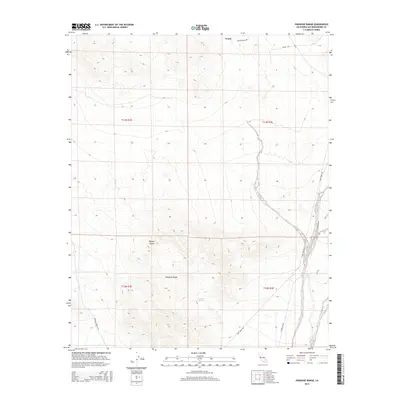
2015 Map of Paradise Range
USGS Topo · Published 2015About this map
Venus sits at the northern edge of this arid landscape, a site marked by the junction of Venus Station Rd and Gemini Sta. The terrain is dominated by the Paradise Range, which rises from the floor of the Mojave Desert. This area serves as a critical corridor for military and infrastructure logistics, evidenced by the presence of the Fort Irwin Rd, the Ammo Route, and an extensive Power Line Rd. Water sources are few but significant in this desert environment, with Paradise Springs and Jack Spring providing rare points of relief. The map reveals the intricate network of desert tracks such as Paradise Springs Rd, which connects the rugged uplands to the established transit routes that skirt the mountains.
Find a feature on this map
16 named features on this map. Tap any name to fly to it.
Don’t see what you’re looking for? This feature index may not catch every label — zoom into the map to look around manually.
Map Details
Editions of this 2015 Paradise Range Map
This is the sole edition of this map. No revisions or reprints were ever made.
Other maps of this area

1933 · Avawatz Mountains
USGS Topo · 1:250,000

1947 · Trona
USGS Topo · 1:250,000

1948 · Trona
USGS Topo · 1:250,000

1948 · Alvord Mountain
USGS Topo · 1:62,500

1948 · Lane Mountain
USGS Topo · 1:62,500

1948 · Goldstone Lake
USGS Topo · 1:62,500

1948 · Tiefort Mountains
USGS Topo · 1:62,500

1951 · Goldstone Lake
USGS Topo · 1:62,500

1951 · Tiefort Mountains
USGS Topo · 1:62,500

1951 · Alvord Mountain
USGS Topo · 1:62,500