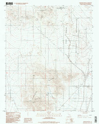
1996 Map of Paradise Range
USGS Topo · Published 1998About this map
The Paradise Range dominates this San Bernardino County landscape, defined by a legacy of desert mining and modern aerospace technology. Located within the Fort Irwin Military Reservation, the area shows a clear transition from traditional extraction to scientific observation. The northern portion of the map is notable for the Goldstone Deep Space Communications Complex Venus 3556.9, while several Radio Tower and Radio Facility sites are positioned on the higher elevations.
Find a feature on this map
19 named features on this map. Tap any name to fly to it.
Don’t see what you’re looking for? This feature index may not catch every label — zoom into the map to look around manually.
Map Details
Editions of this 1996 Paradise Range Map
This is the sole edition of this map. No revisions or reprints were ever made.
Other maps of this area

1933 · Avawatz Mountains
USGS Topo · 1:250,000

1947 · Trona
USGS Topo · 1:250,000

1948 · Trona
USGS Topo · 1:250,000

1948 · Alvord Mountain
USGS Topo · 1:62,500

1948 · Lane Mountain
USGS Topo · 1:62,500

1948 · Goldstone Lake
USGS Topo · 1:62,500

1948 · Tiefort Mountains
USGS Topo · 1:62,500

1951 · Goldstone Lake
USGS Topo · 1:62,500

1951 · Tiefort Mountains
USGS Topo · 1:62,500

1951 · Alvord Mountain
USGS Topo · 1:62,500