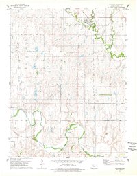
1978 Map of Paradise
USGS Topo · Published 1979About this map
The town of Paradise serves as the focal point for this late-1970s survey, situated along the Union Pacific railroad line where the tracks parallel Paradise Creek. The landscape transition from the high plains down to the Saline River in the southern portion of the sheet reveals a heavy industrial presence, primarily centered on petroleum extraction. Extensive Oil Wells are scattered across the western townships, notably within the Fairport Oil Field and an area designated as Old Field, indicating decades of energy production in this corner of Russell County. Beyond the town and the oil infrastructure, the topography is defined by the winding paths of Eagle Creek and the river valley, where local industry is further evidenced by a Gravel Pit near the riverbank. This map provides a detailed view of the infrastructure supporting a mid-century Kansas oil and ranching community.
Find a feature on this map
15 named features on this map. Tap any name to fly to it.
Don’t see what you’re looking for? This feature index may not catch every label — zoom into the map to look around manually.
Map Details
Editions of this 1978 Paradise Map
This is the sole edition of this map. No revisions or reprints were ever made.
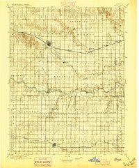
Other maps of this area

1896 · Osborne
USGS Topo · 1:125,000

1896 · Russell
USGS Topo · 1:125,000
1896 · Hays
USGS Topo · 1:125,000

1896 · Plainville
USGS Topo · 1:125,000

1955 · Great Bend
USGS Topo · 1:250,000

1955 · Beloit
USGS Topo · 1:250,000

1957 · Great Bend
USGS Topo · 1:250,000

1958 · Great Bend
USGS Topo · 1:250,000

1959 · Beloit
USGS Topo · 1:250,000
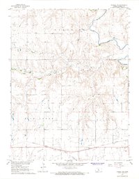
1967 · Russell NW
USGS Topo · 1:24,000