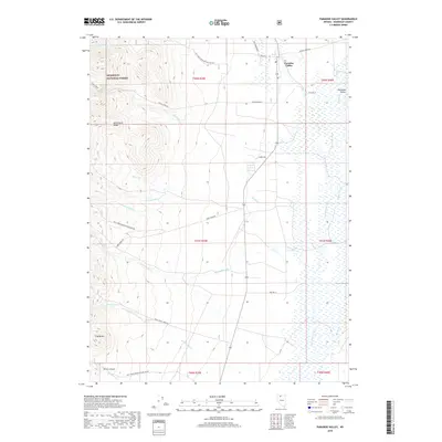
2018 Map of Paradise Valley
USGS Topo · Published 2018About this map
Paradise Valley sits at the eastern edge of the Santa Rosa Range, where mountain drainages give way to a complex network of wetlands and irrigation. This 2018 survey documents a landscape defined by water management and high-desert ranching, with Big Cottonwood Cr and Martin Cr feeding into Adams Slough. To the west, the elevations rise sharply into the Humboldt National Forest, where steep canyons like Provo Canyon and landmarks such as Trap Butte overlook the valley floor. The map traces the rural infrastructure of the region, from Bridge St in the town center to several forest development roads that penetrate the rugged interior of the range. The transition between the arid slopes and the riparian valley floor is marked by numerous perennial and seasonal streams, including Stone House Cr and Wash O'Neal Cr, reflecting the vital hydrology of this Nevada basin.
Find a feature on this map
38 named features on this map. Tap any name to fly to it.
Don’t see what you’re looking for? This feature index may not catch every label — zoom into the map to look around manually.
Map Details
Editions of this 2018 Paradise Valley Map
This is the sole edition of this map. No revisions or reprints were ever made.
Other maps of this area

1882 · Paradise
USGS Topo · 1:250,000

1893 · Paradise
USGS Topo · 1:250,000

1945 · Hot Springs
USGS Topo · 1:62,500

1947 · Hot Springs Peak
USGS Topo · 1:62,500

1955 · McDermitt
USGS Topo · 1:250,000

1958 · Paradise Valley
USGS Topo · 1:62,500

1959 · McDermitt
USGS Topo · 1:250,000

1959 · Hinkey Summit
USGS Topo · 1:62,500

1980 · Spring City
USGS Topo · 1:24,000
1985 · Osgood Mts
USGS Topo · 1:100,000