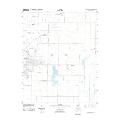
2011 Map of Paragould East
USGS Topo · Published 2011About this map
Paragould serves as the focal point of this eastern Greene County survey, where the urban grid meets the agricultural reaches of Northeast Arkansas. The historical footprint of the Cotton Belt railroad corridor is clearly visible, cutting diagonally through the landscape and influencing the placement of settlements like Unity and Cotton Belt. This era of development shows the city's eastern expansion toward Twin Oaks and Lake Side, while the surrounding rural landscape remains defined by its drainage network.
Find a feature on this map
81 named features on this map. Tap any name to fly to it.
Don’t see what you’re looking for? This feature index may not catch every label — zoom into the map to look around manually.
Map Details
Editions of this 2011 Paragould East Map
This is the sole edition of this map. No revisions or reprints were ever made.
Other maps of this area

1939 · Jonesboro
USGS Topo · 1:62,500

1940 · Gainesville
USGS Topo · 1:62,500

1940 · Marmaduke
USGS Topo · 1:62,500

1941 · Leachville
USGS Topo · 1:62,500

1953 · Memphis
USGS Topo · 1:250,000

1956 · Leachville
USGS Topo · 1:62,500

1956 · Memphis
USGS Topo · 1:250,000

1957 · Poplar Bluff
USGS Topo · 1:250,000

1958 · Jonesboro
USGS Topo · 1:62,500

1958 · Marmaduke
USGS Topo · 1:62,500