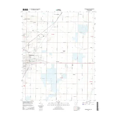
2014 Map of Paragould East
USGS Topo · Published 2014About this map
Paragould serves as the primary urban center for this Greene County landscape, which transitions from a structured city grid into a vast network of section roads and agricultural plots. The northeastern expansion of the city is evident, reaching toward settlements like Morning Star and Twin Oaks. The landscape is defined by the drainage patterns of Eightmile Creek and Hurricane Creek, with the Eight Mile Creek Bridge serving as a key crossing point for local transit.
Find a feature on this map
124 named features on this map. Tap any name to fly to it.
Don’t see what you’re looking for? This feature index may not catch every label — zoom into the map to look around manually.
Map Details
Editions of this 2014 Paragould East Map
This is the sole edition of this map. No revisions or reprints were ever made.
Other maps of this area

1939 · Jonesboro
USGS Topo · 1:62,500

1940 · Gainesville
USGS Topo · 1:62,500

1940 · Marmaduke
USGS Topo · 1:62,500

1941 · Leachville
USGS Topo · 1:62,500

1953 · Memphis
USGS Topo · 1:250,000

1956 · Leachville
USGS Topo · 1:62,500

1956 · Memphis
USGS Topo · 1:250,000

1957 · Poplar Bluff
USGS Topo · 1:250,000

1958 · Jonesboro
USGS Topo · 1:62,500

1958 · Marmaduke
USGS Topo · 1:62,500