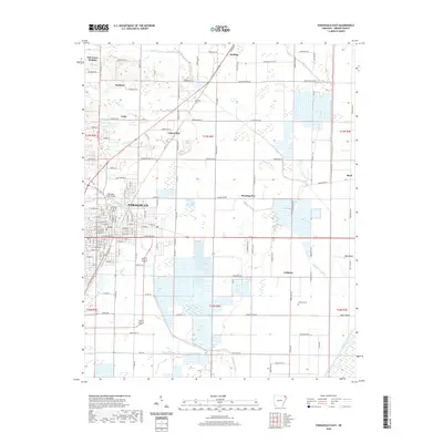
2020 Map of Paragould East
USGS Topo · Published 2020About this map
The Greene County Courthouse serves as the central anchor for the city of Paragould, while the surrounding landscape reveals the deep agricultural and transport roots of Greene County. A intricate network of water management features, including Eightmile Ditch, Village Cr Ditch, and Johnson Cr Ditch, reflects the engineering required to support the fertile farm ground in this part of Arkansas. The historic influence of the railroad is evident through the presence of the Cotton Belt line and the namesake settlement of Cotton Belt. Smaller, enduring communities like Morning Star, Noxburn, and Halliday dot the outskirts, connected by a dense grid of county roads. Genealogists will find interest in localized sites such as Coffman Cem and the small residential clusters at Oak Grove Heights and Unity.
Find a feature on this map
101 named features on this map. Tap any name to fly to it.
Don’t see what you’re looking for? This feature index may not catch every label — zoom into the map to look around manually.
Map Details
Editions of this 2020 Paragould East Map
This is the sole edition of this map. No revisions or reprints were ever made.
Other maps of this area

1939 · Jonesboro
USGS Topo · 1:62,500

1940 · Gainesville
USGS Topo · 1:62,500

1940 · Marmaduke
USGS Topo · 1:62,500

1941 · Leachville
USGS Topo · 1:62,500

1953 · Memphis
USGS Topo · 1:250,000

1956 · Leachville
USGS Topo · 1:62,500

1956 · Memphis
USGS Topo · 1:250,000

1957 · Poplar Bluff
USGS Topo · 1:250,000

1958 · Jonesboro
USGS Topo · 1:62,500

1958 · Marmaduke
USGS Topo · 1:62,500