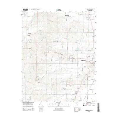
2014 Map of Paragould West
USGS Topo · Published 2014About this map
Crowley's Ridge defines the western terrain of this 2014 Greene County survey, creating a distinct geological break from the flatter plains of eastern Arkansas. The expanding western edge of Paragould is the primary focus, where suburban residential growth meets the rural landscape of the ridge. The map documents an area with deep community roots, evidenced by the high density of local cemeteries such as Linwood Cem, Saint Marys Cem, and Shiloh Cem. Higher education and regional services are anchored by Crowley's Ridge Coll and the Kirk Field Airport. Rural life remains vital in outlying settlements like Pine Knot, Center Hill, and Fairview, while the drainage of the ridge is managed by local watercourses including Eightmile Creek and Village Creek.
Find a feature on this map
165 named features on this map. Tap any name to fly to it.
Don’t see what you’re looking for? This feature index may not catch every label — zoom into the map to look around manually.
Map Details
Editions of this 2014 Paragould West Map
This is the sole edition of this map. No revisions or reprints were ever made.
Other maps of this area

1939 · Jonesboro
USGS Topo · 1:62,500

1940 · Gainesville
USGS Topo · 1:62,500

1940 · Marmaduke
USGS Topo · 1:62,500

1941 · Leachville
USGS Topo · 1:62,500

1953 · Memphis
USGS Topo · 1:250,000

1956 · Leachville
USGS Topo · 1:62,500

1956 · Memphis
USGS Topo · 1:250,000

1957 · Poplar Bluff
USGS Topo · 1:250,000

1958 · Jonesboro
USGS Topo · 1:62,500

1958 · Marmaduke
USGS Topo · 1:62,500