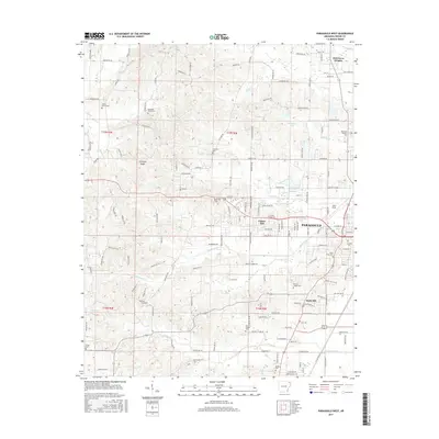
2017 Map of Paragould West
USGS Topo · Published 2017About this map
Crowleys Ridge rises above the alluvial plains of Greene County, providing a distinct topographic break where the residential expansion of Paragould meets the higher ground to the west. This 2017 survey details the suburban interface of the city as it reaches toward Center Hill and Rock Hill. The landscape is heavily marked by its genealogical record, with numerous burial sites such as Union Grove Cem and Mountain Home Cem dotting the ridges and lowlands. Water drainage is a defining characteristic of the area's development, evidenced by the channelization of Village Cr Ditch and the natural winding paths of Eightmile Cr and Jacks Cr. From the heights of Oak Grove Heights in the northeast to the athletic fields at Kirk Field, the map illustrates a region where established rural cemeteries and modern residential growth coexist along the county's primary ridge line.
Find a feature on this map
149 named features on this map. Tap any name to fly to it.
Don’t see what you’re looking for? This feature index may not catch every label — zoom into the map to look around manually.
Map Details
Editions of this 2017 Paragould West Map
This is the sole edition of this map. No revisions or reprints were ever made.
Other maps of this area

1939 · Jonesboro
USGS Topo · 1:62,500

1940 · Gainesville
USGS Topo · 1:62,500

1940 · Marmaduke
USGS Topo · 1:62,500

1941 · Leachville
USGS Topo · 1:62,500

1953 · Memphis
USGS Topo · 1:250,000

1956 · Leachville
USGS Topo · 1:62,500

1956 · Memphis
USGS Topo · 1:250,000

1957 · Poplar Bluff
USGS Topo · 1:250,000

1958 · Jonesboro
USGS Topo · 1:62,500

1958 · Marmaduke
USGS Topo · 1:62,500