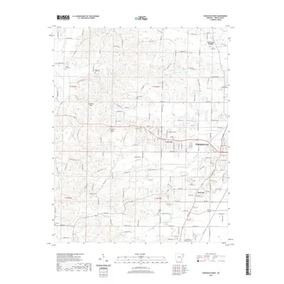
2020 Map of Paragould West
USGS Topo · Published 2020About this map
Crowleys Ridge rises above the surrounding Delta plains, providing a distinct geological backdrop for the western expansion of Paragould and the nearby communities of Center Hill and Oak Grove Heights. This landscape is marked by a high density of rural burial grounds, including the Union Grove Cem, Mountain Home Cem, and the Finch Cem in the southwest, reflecting the deep-rooted family genealogies of Greene County. Education and recreation are centered around Crowley's Ridge College and the aviation activity at Kirk Field. The drainage of the area is defined by numerous winding waterways like Eightmile Cr and Village Cr, which transition into managed channels such as the Village Cr Ditch as they move toward the agricultural lowlands.
Find a feature on this map
169 named features on this map. Tap any name to fly to it.
Don’t see what you’re looking for? This feature index may not catch every label — zoom into the map to look around manually.
Map Details
Editions of this 2020 Paragould West Map
This is the sole edition of this map. No revisions or reprints were ever made.
Other maps of this area

1939 · Jonesboro
USGS Topo · 1:62,500

1940 · Gainesville
USGS Topo · 1:62,500

1940 · Marmaduke
USGS Topo · 1:62,500

1941 · Leachville
USGS Topo · 1:62,500

1953 · Memphis
USGS Topo · 1:250,000

1956 · Leachville
USGS Topo · 1:62,500

1956 · Memphis
USGS Topo · 1:250,000

1957 · Poplar Bluff
USGS Topo · 1:250,000

1958 · Jonesboro
USGS Topo · 1:62,500

1958 · Marmaduke
USGS Topo · 1:62,500