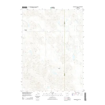
2014 Map of Paramount Valley
USGS Topo · Published 2014About this map
Johnsons Corner and Paramount Valley anchor this topographic look at the Sandhills transition where Brown and Rock counties meet. The landscape is defined by the unique hydrology of north-central Nebraska, characterized by numerous ephemeral ponds and wetlands scattered across the undulating terrain. To the east, Skull Creek drains the northern reaches, while Hornburger Lake provides a permanent water feature in an otherwise arid expanse of rangeland. This 2014 survey captures the region just before mid-decade, showing a sparsely populated agricultural landscape where section lines and local roads provide the primary structural framework for the high plains ranching economy.
Find a feature on this map
5 named features on this map. Tap any name to fly to it.
Don’t see what you’re looking for? This feature index may not catch every label — zoom into the map to look around manually.
Map Details
Editions of this 2014 Paramount Valley Map
This is the sole edition of this map. No revisions or reprints were ever made.
Other maps of this area

1955 · O'Neill
USGS Topo · 1:250,000

1959 · O'Neill
USGS Topo · 1:250,000

1969 · O'Neill
USGS Topo · 1:250,000

1981 · Boiling Spring
USGS Topo · 1:24,000
1981 · Shovel Dot Ranch
USGS Topo · 1:24,000

1981 · Paramount Valley
USGS Topo · 1:24,000

1981 · Rose
USGS Topo · 1:24,000

1982 · Raven
USGS Topo · 1:24,000
1982 · Goldman Lake SE
USGS Topo · 1:24,000
1982 · Goldman Lake NE
USGS Topo · 1:24,000