
1981 Map of Boiling Spring
USGS Topo · Published 1981About this map
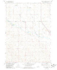
The Calamus River meanders across this northern Nebraska landscape, marking the intersection of four counties: Brown, Rock, Loup, and Blaine. This map, based on 1970s field data, illustrates the specialized ranching economy of the Sandhills. Large family operations such as Bain Ranch and Easy Hour Ranch define the land use, centered around critical water sources like the eponymous Boiling Spring. A Flowing Well and several other wells emphasize the importance of groundwater in this semi-arid environment. Further downstream, the Big Bend Ranch occupies a prominent curve in the river, while the presence of a Claypit and the southern Spencer Ranch indicate varied land resources and longstanding agricultural boundaries in this sparsely populated interior.
Find a feature on this map
14 named features on this map. Tap any name to fly to it.
Don’t see what you’re looking for? This feature index may not catch every label — zoom into the map to look around manually.
Map Details
Editions of this 1981 Boiling Spring Map
This is the sole edition of this map. No revisions or reprints were ever made.
Other maps of this area

1952 · Brewster
USGS Topo · 1:24,000

1952 · Almeria NE
USGS Topo · 1:24,000

1952 · Almeria NW
USGS Topo · 1:24,000

1955 · Broken Bow
USGS Topo · 1:250,000

1955 · O'Neill
USGS Topo · 1:250,000

1956 · Broken Bow
USGS Topo · 1:250,000

1959 · O'Neill
USGS Topo · 1:250,000

1969 · O'Neill
USGS Topo · 1:250,000
1981 · Shovel Dot Ranch
USGS Topo · 1:24,000

1981 · Paramount Valley
USGS Topo · 1:24,000