
1952 Map of Almeria NW
USGS Topo · Published 1954About this map
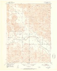
The North Loup River meanders across this rural Nebraska landscape, where the flat floor of Pleasant Valley meets the uniquely named Bloody terrain to the north. Settlement in the early 1950s was sparse, defined by remote outposts such as the Peterson Ranch and a network of one-room schools including School No 15, Pleasant Valley Sch, and West End Sch. The irrigation history of the region is etched into the earth, visible here in the traces of an Abandoned Canal and an Aban'd Canal following the river's path. These defunct waterways, alongside the Church of God, speak to the community's efforts to manage the semi-arid environment of the Sandhills. Numerous windmills are noted across the sheet, marking vital water sources for cattle in the transition from the river valley to the more secluded Dry Valley in the south.
Find a feature on this map
16 named features on this map. Tap any name to fly to it.
Don’t see what you’re looking for? This feature index may not catch every label — zoom into the map to look around manually.
Map Details
Editions of this 1952 Almeria NW Map
4 editions found
Other maps of this area

1952 · Brewster
USGS Topo · 1:24,000

1952 · Almeria NE
USGS Topo · 1:24,000

1952 · Almeria SW
USGS Topo · 1:24,000

1952 · Brewster SE
USGS Topo · 1:24,000

1952 · Almeria
USGS Topo · 1:24,000

1955 · Broken Bow
USGS Topo · 1:250,000

1955 · O'Neill
USGS Topo · 1:250,000

1956 · Broken Bow
USGS Topo · 1:250,000

1959 · O'Neill
USGS Topo · 1:250,000

1969 · O'Neill
USGS Topo · 1:250,000