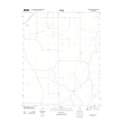
2012 Map of Pardue Camp
USGS Topo · Published 2012About this map
Rita Blanca Cr carves a winding path through the High Plains of Hartley County, defining the drainage patterns and topography of this ranching landscape. The focal point of human activity centers on Pardue Camp, a location linked by a systematic network of section roads including Ranch Road 998 and several numbered county lines. This 2012 survey by the U.S. Geological Survey illustrates a sparsely populated region where the infrastructure is largely dedicated to land management and cattle ranching. The alignment of roads like Co Rd 27 and Co Road H reflects the traditional grid-based surveying typical of the Texas Panhandle, providing a clear record of property access and rural connectivity in the early 21st century.
Find a feature on this map
9 named features on this map. Tap any name to fly to it.
Don’t see what you’re looking for? This feature index may not catch every label — zoom into the map to look around manually.
Map Details
Editions of this 2012 Pardue Camp Map
This is the sole edition of this map. No revisions or reprints were ever made.
Other maps of this area

1954 · Tucumcari
USGS Topo · 1:250,000

1954 · Dalhart
USGS Topo · 1:250,000

1958 · Tucumcari
USGS Topo · 1:250,000

1958 · Dalhart
USGS Topo · 1:250,000

1962 · Dalhart
USGS Topo · 1:250,000

1972 · Hartley SW
USGS Topo · 1:24,000

1973 · Pardue Camp
USGS Topo · 1:24,000

1973 · King SW
USGS Topo · 1:24,000

1973 · Hartley
USGS Topo · 1:24,000

1973 · King
USGS Topo · 1:24,000