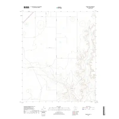
2019 Map of Pardue Camp
USGS Topo · Published 2019About this map
Pardue Camp sits in the southeastern portion of this map, marking a human presence in the expansive ranching landscape of Hartley County. The terrain is defined by the winding course of Rita Blanca Cr, which carves deep, complex drainages through the High Plains. To the west, the broad path of Cottonwood Draw cuts across the prairie, meeting the broken ground near the creek. A grid of rural transportation routes, including Ranch Rd 998, Carson Rd, and Co Rd E, facilitates movement between these remote grazing lands. The map illustrates the stark contrast between the flat upland plateaus and the intricate, eroded breaks leading down to the water, a classic geographic profile of the Texas Panhandle.
Find a feature on this map
10 named features on this map. Tap any name to fly to it.
Don’t see what you’re looking for? This feature index may not catch every label — zoom into the map to look around manually.
Map Details
Editions of this 2019 Pardue Camp Map
This is the sole edition of this map. No revisions or reprints were ever made.
Other maps of this area

1954 · Tucumcari
USGS Topo · 1:250,000

1954 · Dalhart
USGS Topo · 1:250,000

1958 · Tucumcari
USGS Topo · 1:250,000

1958 · Dalhart
USGS Topo · 1:250,000

1962 · Dalhart
USGS Topo · 1:250,000

1972 · Hartley SW
USGS Topo · 1:24,000

1973 · Pardue Camp
USGS Topo · 1:24,000

1973 · King SW
USGS Topo · 1:24,000

1973 · Hartley
USGS Topo · 1:24,000

1973 · King
USGS Topo · 1:24,000