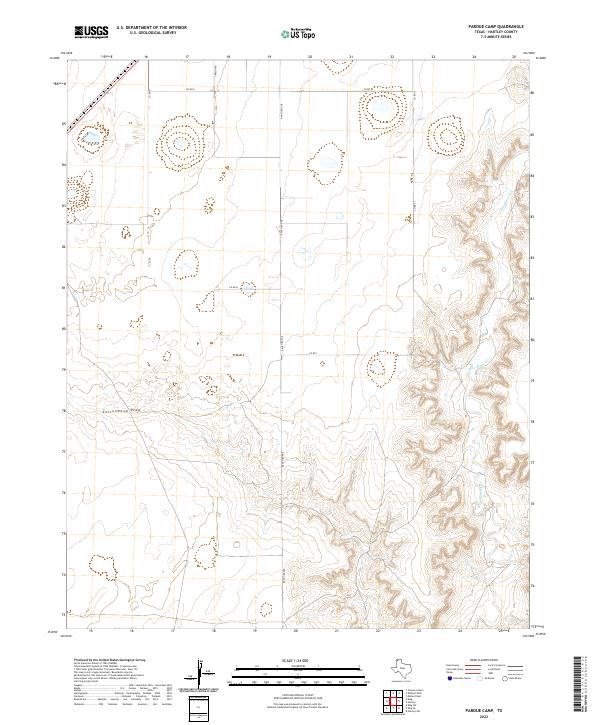
2022 Map of Pardue Camp
USGS Topo · Published 2022About this map
Rita Blanca Cr winds through the eastern portion of this High Plains landscape, creating a complex network of eroded breaks and draws that contrast with the flat tableland to the west. This 2022 U.S. Geological Survey quadrangle reveals a territory defined by large-scale ranching and agriculture, where the topography is dominated by the seasonal drainage of Cottonwood Draw. The human footprint here is primarily a grid of section-line roads, including Co Rd E and Co Rd 27, which provide access to the vast open range. The central corridor is anchored by Ranch Rd 998, serving as a primary north-south artery through this portion of Hartley County. This map is an essential reference for understanding the modern rural infrastructure and water drainage patterns that dictate land use in the Texas Panhandle.
Find a feature on this map
9 named features on this map. Tap any name to fly to it.
Don’t see what you’re looking for? This feature index may not catch every label — zoom into the map to look around manually.
Map Details
Editions of this 2022 Pardue Camp Map
This is the sole edition of this map. No revisions or reprints were ever made.
Other maps of this area

1954 · Tucumcari
USGS Topo · 1:250,000

1954 · Dalhart
USGS Topo · 1:250,000

1958 · Tucumcari
USGS Topo · 1:250,000

1958 · Dalhart
USGS Topo · 1:250,000

1962 · Dalhart
USGS Topo · 1:250,000

1972 · Hartley SW
USGS Topo · 1:24,000

1973 · Pardue Camp
USGS Topo · 1:24,000

1973 · King SW
USGS Topo · 1:24,000

1973 · Hartley
USGS Topo · 1:24,000

1973 · King
USGS Topo · 1:24,000