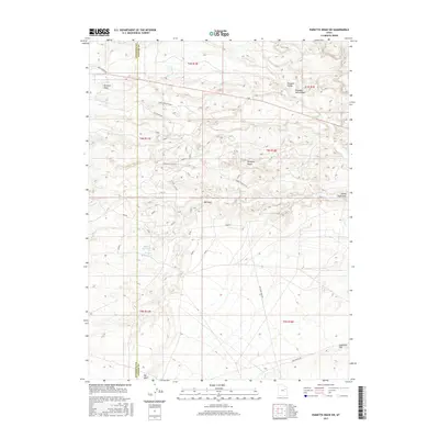
2017 Map of Pariette Draw SW
USGS Topo · Published 2017About this map
Pariette Draw and the surrounding drainage systems of the Uinta Basin define this arid landscape in Uintah and Duchesne counties. The terrain is a network of complex erosional features, including Big Wash, Castle Peak Draw, and the expansive Pariette Bench. This modern survey details a region where water management is critical for the local ranching and energy landscape, evidenced by the presence of Butte Reservoir and Billeys Reservoir to the southwest. The geography is also marked by a grid of access routes such as Castle Peak Rd and Wells Draw Rd, which cross the high desert terrain. Further east, the land opens into Eightmile Flat and Pleasant Valley, where the Pleasant Valley Wash provides a primary drainage route toward the Green River basin. The map captures the interface between these deep draws and the flat-topped benches that characterize this part of eastern Utah.
Find a feature on this map
23 named features on this map. Tap any name to fly to it.
Don’t see what you’re looking for? This feature index may not catch every label — zoom into the map to look around manually.
Map Details
Editions of this 2017 Pariette Draw SW Map
This is the sole edition of this map. No revisions or reprints were ever made.
Other maps of this area

1885 · East Tavaputs
USGS Topo · 1:250,000

1885 · Ashley
USGS Topo · 1:250,000

1885 · Uinta
USGS Topo · 1:250,000

1886 · Price River
USGS Topo · 1:250,000

1896 · Price River
USGS Topo · 1:250,000

1917 · Vernal
USGS Topo · 1:125,000

1939 · Duchesne
USGS Topo · 1:125,000

1953 · Nutters Hole
USGS Topo · 1:62,500

1954 · Salt Lake City
USGS Topo · 1:250,000

1954 · Vernal
USGS Topo · 1:250,000