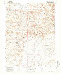
1964 Map of Pariette Draw SW
USGS Topo · Published 1966About this map
The Old Indian Treaty Boundary carves a sharp diagonal across this arid landscape, marking a historical line of demarcation between the Uintah and Ouray Reservation lands and the surrounding public domain. This 1964 survey captures a moment of resource development within the high desert, where scattered Oil Wells, Prospects, and a Drill Hole point to subsurface exploration. The terrain is defined by deep erosion, with Pariette Draw and Pleasant Valley Wash draining the plateau into complex systems like Big Wash and Sheep Wash. Water management is evident in small, isolated catchments such as Billeys Res, Butte Reservoir, and Snyder Reservoir, which were essential for sustaining livestock across Eightmile Flat. This map is particularly valuable for its depiction of the early industrial footprint and the persistence of nineteenth-century boundary lines in the modern Uinta Basin.
Find a feature on this map
16 named features on this map. Tap any name to fly to it.
Don’t see what you’re looking for? This feature index may not catch every label — zoom into the map to look around manually.
Map Details
Editions of this 1964 Pariette Draw SW Map
This is the sole edition of this map. No revisions or reprints were ever made.
Other maps of this area

1885 · East Tavaputs
USGS Topo · 1:250,000

1885 · Ashley
USGS Topo · 1:250,000

1885 · Uinta
USGS Topo · 1:250,000

1886 · Price River
USGS Topo · 1:250,000

1896 · Price River
USGS Topo · 1:250,000

1917 · Vernal
USGS Topo · 1:125,000

1939 · Duchesne
USGS Topo · 1:125,000

1953 · Nutters Hole
USGS Topo · 1:62,500

1954 · Salt Lake City
USGS Topo · 1:250,000

1954 · Vernal
USGS Topo · 1:250,000