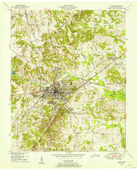
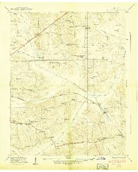
1950 Map of Paris
USGS Topo · Published 1950About this map
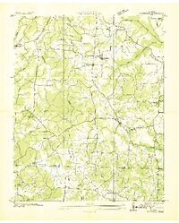
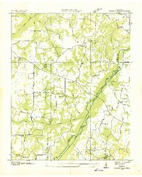
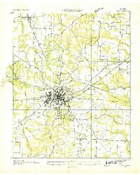
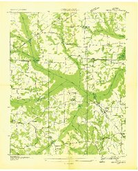
Paris serves as a significant rail and commercial hub at the midpoint of the century, defined by the junction of the Nashville Chattanooga and St Louis Railway and the Louisville and Nashville Railroad. This dual-rail infrastructure supported a bustling town core, surrounded by a landscape of small agricultural settlements and family-named landmarks. The topography is shaped by the Tennessee Valley Divide, which separates the drainages of Town Creek and Bailey Fork in the east from the Obion River system to the west. Local genealogy and community life are well-documented through a dense network of rural landmarks, including the Bird Creek Church, Grove Sch, and the Paris Memorial Cemetery. Notable water features such as Jones Bend Lake and Green Acres Lake highlight the managed water resources of Henry County, while the northern reaches show the smaller village of Whitlock.
Find a feature on this map
54 named features on this map. Tap any name to fly to it.
Don’t see what you’re looking for? This feature index may not catch every label — zoom into the map to look around manually.
Map Details
Editions of this 1950 Paris Map
This is the sole edition of this map. No revisions or reprints were ever made.
Other maps of this area
1936 · Conyersville
USGS Topo · 1:24,000
1936 · Buchanan
USGS Topo · 1:24,000
1936 · Crossland
USGS Topo · 1:24,000
1936 · Mansfield
USGS Topo · 1:24,000
1936 · Manleyville
USGS Topo · 1:24,000
1936 · Paris
USGS Topo · 1:24,000
1936 · Springville
USGS Topo · 1:24,000
1938 · Springville
USGS Topo · 1:24,000
1940 · Manleyville
USGS Topo · 1:24,000
1941 · Manleyville
USGS Topo · 1:24,000