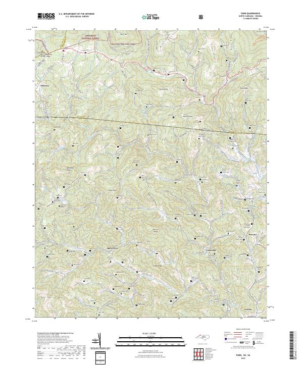
2022 Map of Park
USGS Topo · Published 2022About this map
Jefferson National Forest spans the northern reaches of this borderland, where the high country of North Carolina meets Virginia. The landscape is defined by the steep crests of Bluff Mtn and Cabin Ridge, with drainage systems like Helton Cr and Big Horse Cr cutting deep valleys that have historically dictated the placement of mountain settlements. This 2022 survey documents a dense network of family heritage sites, specifically highlighting the numerous small cemeteries that dot the hillsides, such as the John Henry Eldreth Cem and Osborne Family Cem. The historic Virginia Creeper Trl follows the old rail grade in the northwest corner near Whitetop, while more recent developments connect mountain communities like Apple Grove and Tuckerdale via winding routes such as State Rte 600.
Find a feature on this map
184 named features on this map. Tap any name to fly to it.
Don’t see what you’re looking for? This feature index may not catch every label — zoom into the map to look around manually.
Map Details
Editions of this 2022 Park Map
This is the sole edition of this map. No revisions or reprints were ever made.
Other maps of this area

1889 · Wytheville
USGS Topo · 1:125,000

1889 · Wilkesboro
USGS Topo · 1:125,000

1891 · Abingdon
USGS Topo · 1:125,000

1891 · Wilkesboro
USGS Topo · 1:125,000

1892 · Wytheville
USGS Topo · 1:125,000

1893 · Cranberry
USGS Topo · 1:125,000

1894 · Abingdon
USGS Topo · 1:125,000

1895 · Cranberry
USGS Topo · 1:125,000

1899 · Cranberry
USGS Topo · 1:125,000

1902 · Cranberry
USGS Topo · 1:125,000