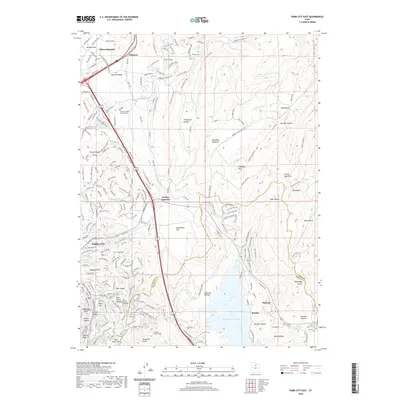
2020 Map of Park City East
USGS Topo · Published 2020About this map
Park City anchors this 2020 landscape where high-altitude development meets industrial heritage and modern recreation. The transition from mining to luxury resort is evident near Ontario Canyon and the Ontario Drain Tunnel, marking the deep subterranean infrastructure that once defined the local economy. To the east, the Jordanelle Reservoir fills the valley floor, reshaping the terrain south of Keetley and Hideout. Modern transport and leisure corridors follow historical lines, such as the Rail Trail which runs through Atkinson and Silver Summit. The map captures a high degree of contemporary residential expansion into the Wasatch Range foothills, particularly around Deer Valley and the northern residential reaches of Mountain Meadows, while legacy features like Masonic Hill and the Summit County Court House ground the area in its civic and social roots.
Find a feature on this map
190 named features on this map. Tap any name to fly to it.
Don’t see what you’re looking for? This feature index may not catch every label — zoom into the map to look around manually.
Map Details
Editions of this 2020 Park City East Map
This is the sole edition of this map. No revisions or reprints were ever made.
Other maps of this area

1885 · Salt Lake
USGS Topo · 1:250,000

1900 · Coalville
USGS Topo · 1:125,000

1903 · Coalville
USGS Topo · 1:125,000

1925 · Ft. Douglas
USGS Topo · 1:125,000

1928 · Ft. Douglas
USGS Topo · 1:125,000

1954 · Salt Lake City
USGS Topo · 1:250,000

1955 · Heber
USGS Topo · 1:24,000

1955 · Park City East
USGS Topo · 1:24,000

1955 · Brighton
USGS Topo · 1:24,000

1955 · Park City West
USGS Topo · 1:24,000