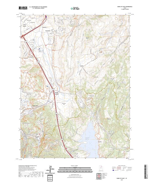
2023 Map of Park City East
USGS Topo · Published 2023About this map
Park City sits at the southwestern edge of this modern landscape, where the eastern slopes of the Wasatch Range meet the burgeoning residential developments of Silver Summit and Hideout. The map documents a significant transformation of the terrain, particularly around the northern reaches of the Jordanelle Reservoir, which now covers areas near the older settlement of Keetley. The intersection of recreation and civic life is evident, with the Summit County Court House located near the high-traffic corridor of modern highways and the repurposed Rail Trail.
Find a feature on this map
175 named features on this map. Tap any name to fly to it.
Don’t see what you’re looking for? This feature index may not catch every label — zoom into the map to look around manually.
Map Details
Editions of this 2023 Park City East Map
This is the sole edition of this map. No revisions or reprints were ever made.
Other maps of this area

1885 · Salt Lake
USGS Topo · 1:250,000

1900 · Coalville
USGS Topo · 1:125,000

1903 · Coalville
USGS Topo · 1:125,000

1925 · Ft. Douglas
USGS Topo · 1:125,000

1928 · Ft. Douglas
USGS Topo · 1:125,000

1954 · Salt Lake City
USGS Topo · 1:250,000

1955 · Heber
USGS Topo · 1:24,000

1955 · Park City East
USGS Topo · 1:24,000

1955 · Brighton
USGS Topo · 1:24,000

1955 · Park City West
USGS Topo · 1:24,000