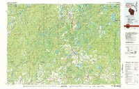
1980 Map of Park Falls
USGS Topo · Published 1980About this map
Flambeau River State Forest and the Chequamegon National Forest dominate this 1980 survey, illustrating a landscape defined by industrial forestry and conservation. The Flambeau River and its various forks carve through the terrain, historically serving as the primary arteries for the region's timber economy. Settlements such as Park Falls, Phillips, and Prentice are anchored by the Soo Line railroad, which provided the essential terrestrial link for the export of northern woods.
Find a feature on this map
116 named features on this map. Tap any name to fly to it.
Don’t see what you’re looking for? This feature index may not catch every label — zoom into the map to look around manually.
Map Details
Editions of this 1980 Park Falls Map
This is the sole edition of this map. No revisions or reprints were ever made.
Other maps of this area

1938 · Lac Du Flambeau
USGS Topo · 1:48,000

1939 · Lac Du Flambeau
USGS Topo · 1:48,000

1939 · Mc Cord
USGS Topo · 1:48,000

1939 · Winchester
USGS Topo · 1:48,000

1940 · Mercer
USGS Topo · 1:48,000

1940 · Butternut
USGS Topo · 1:48,000

1941 · Park Falls
USGS Topo · 1:48,000

1941 · Pike Lake
USGS Topo · 1:48,000

1941 · Kennan
USGS Topo · 1:48,000

1941 · Kennedy
USGS Topo · 1:48,000