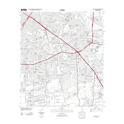
2013 Map of Park Place
USGS Topo · Published 2013About this map
Buffalo Bayou and its winding tributaries like Brays Bayou and Sims Bayou carve through this industrial and residential landscape southeast of downtown Houston. The area is defined by its deep connection to the regional shipping and transit economy, featuring the prominent William P Hobby Airport and the heavy industrial waterfronts of Manchester and Harrisburg. Neighborhoods such as Magnolia Park and Eastwood reflect the urban expansion of the early 21st century, while the density of memorial sites like Evergreen Cem and Forest Park Cem provide a stable record for genealogical research.
Find a feature on this map
70 named features on this map. Tap any name to fly to it.
Don’t see what you’re looking for? This feature index may not catch every label — zoom into the map to look around manually.
Map Details
Editions of this 2013 Park Place Map
This is the sole edition of this map. No revisions or reprints were ever made.
Other maps of this area

1915 · Bellaire
USGS Topo · 1:24,000

1915 · Park Place
USGS Topo · 1:24,000

1915 · Houston Heights
USGS Topo · 1:24,000

1915 · Deepwater
USGS Topo · 1:24,000

1916 · Genoa
USGS Topo · 1:24,000

1916 · Settegast
USGS Topo · 1:24,000

1916 · Fauna
USGS Topo · 1:24,000

1919 · Deepwater
USGS Topo · 1:31,680

1920 · Genoa
USGS Topo · 1:31,680
1920 · Fauna
USGS Topo · 1:31,680