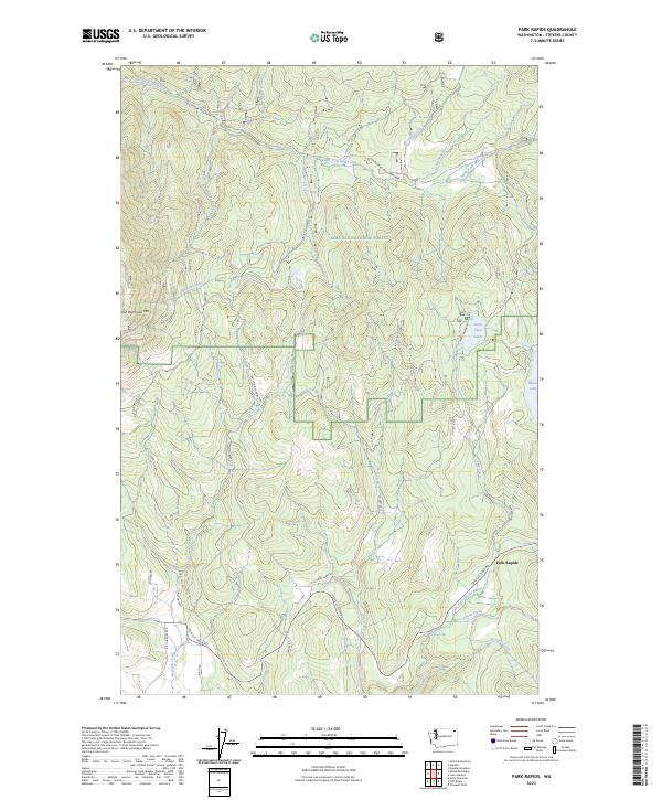
2023 Map of Park Rapids
USGS Topo · Published 2023About this map
Park Rapids sits at the junction of Colville-Tiger Rd and the Little Pend Oreille River in this modern-era study of Stevens County. The landscape is defined by the expansive Colville National Forest and the Little Pend Oreille National Wildlife Refuge, which protect significant river systems including Cedar Creek and Prospect Creek. The terrain is characterized by high-elevation points such as Old Dominion Mtn, with a network of forest roads like Hanson Creek Rd and Seigel Hill Rd providing access to water bodies like Little Twin Lakes and Black Lake. The presence of Crystal Falls along the river highlights the significant elevation changes that drive the local hydrology. This 2023 survey documents the intersection of public land management and small-scale settlement near the western edge of the Selkirk Mountains.
Find a feature on this map
40 named features on this map. Tap any name to fly to it.
Don’t see what you’re looking for? This feature index may not catch every label — zoom into the map to look around manually.
Map Details
Editions of this 2023 Park Rapids Map
This is the sole edition of this map. No revisions or reprints were ever made.
Other maps of this area

1927 · Chewelah
USGS Topo · 1:125,000

1929 · Colville
USGS Topo · 1:125,000

1930 · Chewelah
USGS Topo · 1:125,000

1933 · Colville
USGS Topo · 1:125,000

1952 · Gillette Mtn
USGS Topo · 1:24,000

1952 · White Mud Lake
USGS Topo · 1:24,000

1952 · Aladdin
USGS Topo · 1:24,000

1958 · Sandpoint
USGS Topo · 1:250,000

1963 · Sandpoint
USGS Topo · 1:250,000

1964 · Cliff Ridge
USGS Topo · 1:24,000