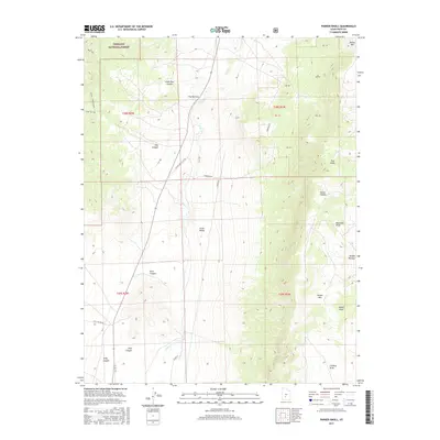
2017 Map of Parker Knoll
USGS Topo · Published 2017About this map
Fishlake National Forest occupies the northwestern corner of this Piute County terrain, where the high elevations of the Awapa Plateau transition into the drainages of Grass Valley. The landscape is defined by the corridor of Otter Cr, which flows south through The Narrows, flanked by complex relief features including Parker Mtn and the namesake Parker Knoll. The map reveals a network of rural routes such as Otter Creek Flat Rd and Blood Ln, which follow the natural contours of the valley floor to connect remote canyons. From the steep walls of Rock Canyon and Pine Canyon to the open stretches of Forshea Draw, the survey captures a section of the Utah interior shaped by livestock movement and rugged watercourses.
Find a feature on this map
27 named features on this map. Tap any name to fly to it.
Don’t see what you’re looking for? This feature index may not catch every label — zoom into the map to look around manually.
Map Details
Editions of this 2017 Parker Knoll Map
This is the sole edition of this map. No revisions or reprints were ever made.
Other maps of this area

1885 · Beaver
USGS Topo · 1:250,000

1885 · Fish Lake
USGS Topo · 1:250,000

1896 · Fish Lake
USGS Topo · 1:250,000

1945 · Marysvale
USGS Topo · 1:62,500

1947 · Marysvale
USGS Topo · 1:62,500

1953 · Richfield
USGS Topo · 1:250,000

1956 · Salina
USGS Topo · 1:250,000

1958 · Richfield
USGS Topo · 1:250,000

1960 · Salina
USGS Topo · 1:250,000

1962 · Salina
USGS Topo · 1:250,000