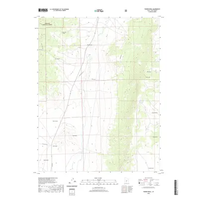
2020 Map of Parker Knoll
USGS Topo · Published 2020About this map
Fishlake National Forest defines the high-country character of this Piute County landscape, where the terrain shifts from the deep drainage of Grass Valley to the elevated expanse of the Awapa Plateau. The central watercourse, Otter Cr, carves a distinct path through The Narrows, paralleled by early transportation routes such as Otter Creek Flat Rd and the legacy path of Old Hwy 62. This area is marked by significant topographical landmarks including Parker Mtn and Parker Knoll, which overlook a network of seasonal water features like Dog Lake and Mud Lake. The map details numerous canyons and draws, such as Rock Canyon and Forshea Draw, illustrating the complex erosion patterns and high-elevation land use typical of this section of south-central Utah.
Find a feature on this map
22 named features on this map. Tap any name to fly to it.
Don’t see what you’re looking for? This feature index may not catch every label — zoom into the map to look around manually.
Map Details
Editions of this 2020 Parker Knoll Map
This is the sole edition of this map. No revisions or reprints were ever made.
Other maps of this area

1885 · Beaver
USGS Topo · 1:250,000

1885 · Fish Lake
USGS Topo · 1:250,000

1896 · Fish Lake
USGS Topo · 1:250,000

1945 · Marysvale
USGS Topo · 1:62,500

1947 · Marysvale
USGS Topo · 1:62,500

1953 · Richfield
USGS Topo · 1:250,000

1956 · Salina
USGS Topo · 1:250,000

1958 · Richfield
USGS Topo · 1:250,000

1960 · Salina
USGS Topo · 1:250,000

1962 · Salina
USGS Topo · 1:250,000