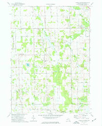
1973 Map of Parkers Corners
USGS Topo · Published 1977About this map
The rural landscape of Parkers Corners and Lamoreaux is defined by a dense network of family-named cemeteries and country crossroads. This 1970s survey documents a region dominated by agricultural reaches and the winding paths of the Red Cedar River, including its West and Middle branches. Genealogists will find significant value in the numerous burial grounds scattered across the townships, such as Paige Cem, Eisele Cem, and Wright Cem, which anchor the local history of the Iosco and Handy districts. The southern edge of the map transitions into the protected wetlands and woods of the Gregory State Game Area. Small-scale industrial activity is limited to scattered Gravel Pits, while local worship centers like Trinity Ch and Mason Road Ch serve as social hubs for the surrounding farmsteads.
Find a feature on this map
45 named features on this map. Tap any name to fly to it.
Don’t see what you’re looking for? This feature index may not catch every label — zoom into the map to look around manually.
Map Details
Editions of this 1973 Parkers Corners Map
This is the sole edition of this map. No revisions or reprints were ever made.
Other maps of this area

1902 · Dexter
USGS Topo · 1:62,500

1904 · Ann Arbor
USGS Topo · 1:125,000

1906 · Dexter
USGS Topo · 1:62,500

1907 · Howell
USGS Topo · 1:62,500

1908 · Ann Arbor
USGS Topo · 1:125,000

1908 · Fowlerville
USGS Topo · 1:62,500

1909 · Howell
USGS Topo · 1:62,500

1910 · Fowlerville
USGS Topo · 1:62,500

1919 · Stockbridge
USGS Topo · 1:62,500

1922 · Stockbridge
USGS Topo · 1:62,500