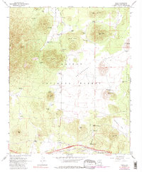
1966 Map of Parks
USGS Topo · Published 1988About this map
The Parks community and the Spring Valley Guard Station anchor this high-altitude landscape within the Kaibab National Forest. The southern portion of the map is dominated by the industrial and transport corridor of the Atchison Topeka and Santa Fe railroad, which runs parallel to the northern edge of the Navajo Army Depot. Evidence of early regional surveying and ranching infrastructure is visible in the numerous named watering holes like Beale Spring and Government Hole, which dot the vast expanse of Government Prairie.
Find a feature on this map
50 named features on this map. Tap any name to fly to it.
Don’t see what you’re looking for? This feature index may not catch every label — zoom into the map to look around manually.
Map Details
Editions of this 1966 Parks Map
4 editions found
Other maps of this area

1886 · San Francisco Mtns
USGS Topo · 1:250,000

1886 · Chino
USGS Topo · 1:250,000

1891 · San Francisco Mtns
USGS Topo · 1:250,000

1891 · Chino
USGS Topo · 1:250,000

1894 · San Francisco Mtns
USGS Topo · 1:250,000

1899 · San Francisco Mtns
USGS Topo · 1:250,000

1908 · Flagstaff
USGS Topo · 1:125,000

1912 · Flagstaff
USGS Topo · 1:125,000

1922 · Williams
USGS Topo · 1:125,000

1947 · Flagstaff
USGS Topo · 1:250,000