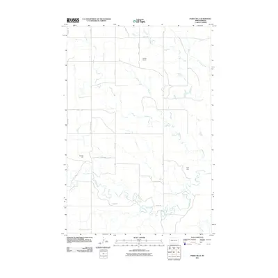
2011 Map of Parks Hills
USGS Topo · Published 2011About this map
Parks Hills and the surrounding plains of Sioux County are defined by a high-prairie network of seasonal drainages and local topographic landmarks. This survey illustrates the rural landscape in the early 21st century, where the terrain rises toward Saddle Buttes and Colville Hill. The land is carved by the meandering paths of Cedar Creek, Crooked Creek, and Whitmore Creek, showing the natural drainage patterns that have historically shaped land use in this part of the Porcupine District. While primarily open country, the map documents a precise grid of rural roads, including W Morristown Rd and E Morristown Rd, providing a clear record of modern access routes through these traditional grazing and agricultural lands.
Find a feature on this map
20 named features on this map. Tap any name to fly to it.
Don’t see what you’re looking for? This feature index may not catch every label — zoom into the map to look around manually.
Map Details
Editions of this 2011 Parks Hills Map
This is the sole edition of this map. No revisions or reprints were ever made.
Other maps of this area

1953 · McIntosh
USGS Topo · 1:250,000

1954 · Bismarck
USGS Topo · 1:250,000

1958 · Bismarck
USGS Topo · 1:250,000

1958 · McIntosh
USGS Topo · 1:250,000

1972 · Paradise Flats
USGS Topo · 1:24,000

1972 · Wheeler Hills
USGS Topo · 1:24,000

1972 · Pretty Rock Butte
USGS Topo · 1:24,000

1972 · Morristown
USGS Topo · 1:24,000

1972 · Pretty Rock Butte SE
USGS Topo · 1:24,000
1972 · Keldron
USGS Topo · 1:24,000