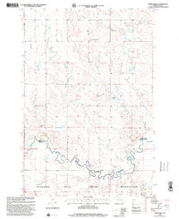
1998 Map of Parks Hills
USGS Topo · Published 2001About this map
Standing Rock Indian Reservation dominates the southern landscape of this North Dakota quadrangle, where the Indian Reservation Boundary follows the meandering course of Cedar Creek. The terrain is defined by dramatic elevations and hydrological networks, notably the Parks Hills and prominent heights such as Saddle Buttes and Colville Hill. In this late-twentieth-century survey, the land remains largely open, marked by drainage patterns from Crooked Creek and Whitmore Creek. The placement of a Drill Hole in the central section suggests exploratory activity within this prairie environment. This map captures the intersection of Grant and Sioux counties, illustrating how geopolitical lines and natural watercourses define the jurisdictional boundaries of the region.
Find a feature on this map
10 named features on this map. Tap any name to fly to it.
Don’t see what you’re looking for? This feature index may not catch every label — zoom into the map to look around manually.
Map Details
Editions of this 1998 Parks Hills Map
This is the sole edition of this map. No revisions or reprints were ever made.
Other maps of this area

1953 · McIntosh
USGS Topo · 1:250,000

1954 · Bismarck
USGS Topo · 1:250,000

1958 · Bismarck
USGS Topo · 1:250,000

1958 · McIntosh
USGS Topo · 1:250,000

1972 · Paradise Flats
USGS Topo · 1:24,000

1972 · Wheeler Hills
USGS Topo · 1:24,000

1972 · Pretty Rock Butte
USGS Topo · 1:24,000

1972 · Morristown
USGS Topo · 1:24,000

1972 · Pretty Rock Butte SE
USGS Topo · 1:24,000
1972 · Keldron
USGS Topo · 1:24,000