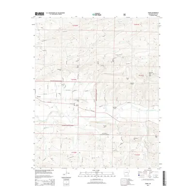
2014 Map of Parks
USGS Topo · Published 2014About this map
The Fourche LaFave River valley anchors this area of Scott County, where the small community of Parks serves as a local hub along E AR 28 Hwy. This landscape is defined by the high, wooded ridges of the Ouachita National Forest, including Salt Log Mtn and the prominent McCafferty Hollow High Peak. For genealogists and local historians, the map provides precise locations for several rural burying grounds, such as Parks Cem, Hawkins Cem, and Jameson Cem. The settlement pattern follows the drainages and gaps between heights, with names like John Allen Hollow and Schoolhouse Ridge suggesting the historical layout of family homesteads and early social centers. To the west, the hamlet of Keener marks the edge of the more heavily timbered upland terrain.
Find a feature on this map
70 named features on this map. Tap any name to fly to it.
Don’t see what you’re looking for? This feature index may not catch every label — zoom into the map to look around manually.
Map Details
Editions of this 2014 Parks Map
This is the sole edition of this map. No revisions or reprints were ever made.
Other maps of this area

1879 · Poteau Mountain
USGS Topo · 1:62,500

1887 · Poteau Mountain #1
USGS Topo · 1:62,500

1887 · Mount Ida #2
USGS Topo · 1:62,500

1890 · Mount Ida
USGS Topo · 1:125,000

1890 · Poteau Mountain
USGS Topo · 1:125,000

1899 · Poteau Mountain
USGS Topo · 1:125,000

1939 · Waldron
USGS Topo · 1:62,500

1940 · Waldron
USGS Topo · 1:62,500

1941 · Waldron
USGS Topo · 1:62,500

1949 · Waldron
USGS Topo · 1:62,500