
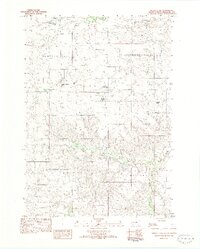
1969 Map of Parmelee NE
USGS Topo · Published 1971About this map
Rosebud Indian Reservation land defines this late-1960s landscape, where the prairie topography is carved by a complex network of drainage systems including Corn Creek to the north and Meat Cut Creek to the south. The area transitions from the high ground of Black Pipe and Surprise Valley down to the settlement of Gray, providing a clear look at the rural infrastructure of the period. Local genealogy and community life are anchored by the St Johns Ch and its adjacent Cem, while the presence of Ring Landing Field suggests the importance of light aircraft for navigating these expansive rangelands. Further evidence of the local economy and land use is visible in the scattered Gravel Pit sites and the winding paths of Dogtail Creek and Swimmer Creek across the Mellette Co Todd Co line.
Find a feature on this map
14 named features on this map. Tap any name to fly to it.
Don’t see what you’re looking for? This feature index may not catch every label — zoom into the map to look around manually.
Map Details
Editions of this 1969 Parmelee NE Map
This is the sole edition of this map. No revisions or reprints were ever made.
Other maps of this area

1955 · Martin
USGS Topo · 1:250,000

1958 · Martin
USGS Topo · 1:250,000

1969 · Norris
USGS Topo · 1:24,000

1969 · Eagle Mans Butte
USGS Topo · 1:24,000

1969 · Soldier Creek
USGS Topo · 1:24,000

1969 · Parmelee
USGS Topo · 1:24,000

1969 · Soldier Creek NW
USGS Topo · 1:24,000

1980 · Kadoka
USGS Topo · 1:100,000

1981 · Cedar Butte
USGS Topo · 1:25,000
1982 · Murdo 3 NW
USGS Topo · 1:25,000