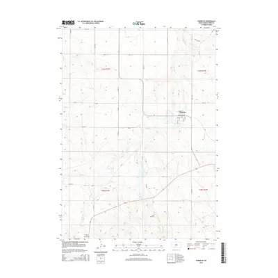
2015 Map of Parmelee
USGS Topo · Published 2015About this map
Parmelee serves as the central hub of this landscape within the Rosebud Reservation, where a strictly organized grid of streets including Adams St and Cottonwood St meets the winding paths of the High Plains. The surrounding terrain is defined by a complex drainage network where Cut Meat Cr and White Horse Cr carve through the prairie. These watercourses are vital landmarks in a region where local geography is often tied to family and tribal history, as seen in the placement of Hollow Horn Bear Cem and White Horse Cem. Smaller bodies of water like Eagle Feather Lake and He-Dog Lake provide rare breaks in the grassland. The map reveals a transition from the structured township system to the more localized road network of the Bia 7 and Bia 4, reflecting the unique administrative and cultural layout of South Dakota's tribal lands in the early 21st century.
Find a feature on this map
41 named features on this map. Tap any name to fly to it.
Don’t see what you’re looking for? This feature index may not catch every label — zoom into the map to look around manually.
Map Details
Editions of this 2015 Parmelee Map
This is the sole edition of this map. No revisions or reprints were ever made.
Other maps of this area

1955 · Martin
USGS Topo · 1:250,000

1958 · Martin
USGS Topo · 1:250,000

1969 · Norris
USGS Topo · 1:24,000

1969 · Eagle Mans Butte
USGS Topo · 1:24,000

1969 · Parmelee NE
USGS Topo · 1:24,000

1969 · Soldier Creek
USGS Topo · 1:24,000

1969 · Parmelee
USGS Topo · 1:24,000

1969 · Soldier Creek NW
USGS Topo · 1:24,000

1969 · Iron Shell Flat East
USGS Topo · 1:24,000

1969 · Iron Shell Flat West
USGS Topo · 1:24,000