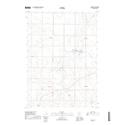
2017 Map of Parmelee
USGS Topo · Published 2017About this map
Parmelee serves as the central hub of this Rosebud Indian Reservation landscape, where a grid of local streets like Adams St and Todd Ave meets the open prairie. The area is defined by its deep cultural and communal roots, evidenced by the presence of significant sites such as Holy Innocents Cem and the Hollow Horn Bear Cem. Numerous waterways, including Cut Meat Cr and White Horse Cr, carve through the terrain, supporting local landmarks like Eagle Feather Lake and He Dog Lake. The road network, including He Dog School Rd and Little Thunder Rd, reflects a landscape organized around family names and community services. This 2017 survey by the U.S. Geological Survey captures the contemporary layout of the Todd County countryside, preserving the spatial relationship between its residential clusters and the natural drainages of the Phister Cr and Magpie Cr.
Find a feature on this map
32 named features on this map. Tap any name to fly to it.
Don’t see what you’re looking for? This feature index may not catch every label — zoom into the map to look around manually.
Map Details
Editions of this 2017 Parmelee Map
This is the sole edition of this map. No revisions or reprints were ever made.
Other maps of this area

1955 · Martin
USGS Topo · 1:250,000

1958 · Martin
USGS Topo · 1:250,000

1969 · Norris
USGS Topo · 1:24,000

1969 · Eagle Mans Butte
USGS Topo · 1:24,000

1969 · Parmelee NE
USGS Topo · 1:24,000

1969 · Soldier Creek
USGS Topo · 1:24,000

1969 · Parmelee
USGS Topo · 1:24,000

1969 · Soldier Creek NW
USGS Topo · 1:24,000

1969 · Iron Shell Flat East
USGS Topo · 1:24,000

1969 · Iron Shell Flat West
USGS Topo · 1:24,000