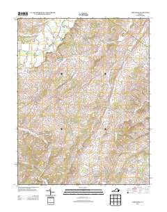
2013 Map of Parnassus
USGS Topo · Published 2013About this map
The North River and Middle River frame this section of the Shenandoah Valley, where the landscape is defined by traditional agriculture and striking geological formations. The area is home to Natural Chimneys, a series of limestone towers that have long served as a local landmark near Mount Solon. Settlement patterns here reflect a long history of family farming, with active operations like the Weaver Brothers Dairy and Gardner's Dairy and Poultry Farm situated alongside established communities such as Parnassus and Moscow. The presence of Hillview Farm and Hidden Acres Farm emphasizes the rural character of the terrain. The network of winding roads, including Old School Ln and Emmanuel Church Rd, connects these scattered hamlets and farmsteads through Glade Valley and across Mossy Cr.
Find a feature on this map
109 named features on this map. Tap any name to fly to it.
Don’t see what you’re looking for? This feature index may not catch every label — zoom into the map to look around manually.
Map Details
Editions of this 2013 Parnassus Map
This is the sole edition of this map. No revisions or reprints were ever made.
Other maps of this area

1892 · Harrisonburg
USGS Topo · 1:125,000

1894 · Staunton
USGS Topo · 1:125,000

1934 · Waynesboro
USGS Topo · 1:48,000

1939 · Waynesboro
USGS Topo · 1:62,500

1941 · Harrisonburg
USGS Topo · 1:62,500

1943 · Harrisonburg
USGS Topo · 1:62,500

1944 · Parnassus
USGS Topo · 1:62,500

1944 · Staunton
USGS Topo · 1:62,500

1947 · Staunton
USGS Topo · 1:62,500

1947 · Parnassus
USGS Topo · 1:62,500