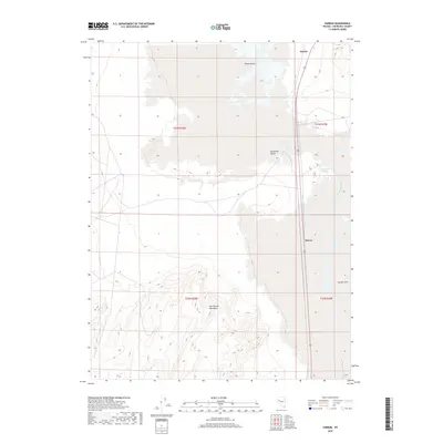
2018 Map of Parran
USGS Topo · Published 2018About this map
Parran and Huxley sit along a primary transit corridor through the arid basin of Churchill County. This landscape is defined by the stark expanse of the Fortymile Desert and the White Plains, areas historically known for their challenging terrain during westward migration. To the south, the topography shifts abruptly into the jagged peaks of the Hot Springs Mountains, providing a vertical contrast to the surrounding alkali flats. The presence of Humboldt Slough and the edge of the Carson Sink indicates the terminal drainage patterns of the region, where seasonal waters gather and evaporate. This map illustrates the intersection of modern infrastructure with these formidable natural barriers, documenting how settlement patterns remain concentrated along the narrow passage between the desert wastes and the rising mountains.
Find a feature on this map
11 named features on this map. Tap any name to fly to it.
Don’t see what you’re looking for? This feature index may not catch every label — zoom into the map to look around manually.
Map Details
Editions of this 2018 Parran Map
This is the sole edition of this map. No revisions or reprints were ever made.
Other maps of this area

1908 · Carson Sink
USGS Topo · 1:250,000

1910 · Carson Sink
USGS Topo · 1:250,000

1950 · Stillwater
USGS Topo · 1:62,500

1951 · Soda Lake
USGS Topo · 1:62,500

1951 · Carson Sink
USGS Topo · 1:62,500

1951 · Desert Peak
USGS Topo · 1:62,500

1957 · Reno
USGS Topo · 1:250,000

1959 · Reno
USGS Topo · 1:250,000

1960 · Reno
USGS Topo · 1:250,000

1979 · Carson Sink
USGS Topo · 1:100,000