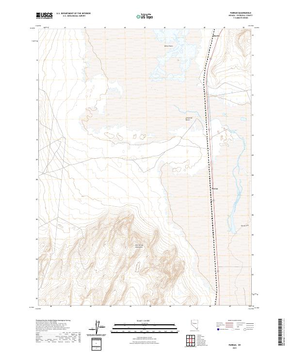
2021 Map of Parran
USGS Topo · Published 2021About this map
The Fortymile Desert dominates this arid Churchill County landscape, a segment of the Great Basin known for its historical challenges to westward travelers. In the northern reaches, the flat expanse of White Plains gives way to the southern rise of the Hot Springs Mountains, where topographic contours reveal the complex geology of the high desert. The small settlements of Huxley and Parran sit along the corridor of Route 95, marking human presence in a territory defined by salt flats and seasonal water. The eastern edge of the map features the Humboldt Slough and the vast, low-lying Carson Sink, illustrating the terminal drainage patterns where interior rivers once vanished into the desert floor.
Find a feature on this map
12 named features on this map. Tap any name to fly to it.
Don’t see what you’re looking for? This feature index may not catch every label — zoom into the map to look around manually.
Map Details
Editions of this 2021 Parran Map
This is the sole edition of this map. No revisions or reprints were ever made.
Other maps of this area

1908 · Carson Sink
USGS Topo · 1:250,000

1910 · Carson Sink
USGS Topo · 1:250,000

1950 · Stillwater
USGS Topo · 1:62,500

1951 · Soda Lake
USGS Topo · 1:62,500

1951 · Carson Sink
USGS Topo · 1:62,500

1951 · Desert Peak
USGS Topo · 1:62,500

1957 · Reno
USGS Topo · 1:250,000

1959 · Reno
USGS Topo · 1:250,000

1960 · Reno
USGS Topo · 1:250,000

1979 · Carson Sink
USGS Topo · 1:100,000