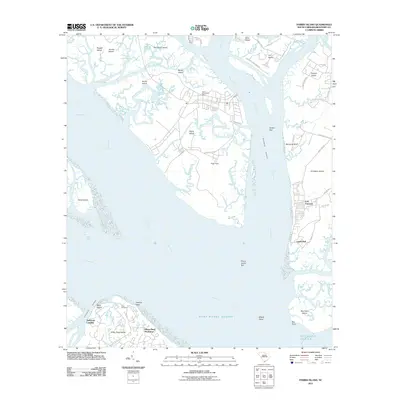
2011 Map of Parris Island
USGS Topo · Published 2011About this map
Parris Island and its surrounding archipelago define this coastal landscape at the confluence of the Port Royal Sound and the Broad River. The map illustrates the specialized infrastructure of the region, including the Parris Island Post Office and Page Field, alongside residential developments like Hilton Head Plantation and Bermuda Bluff. A complex network of tidal waterways, including the Intracoastal Waterway, Whale Branch, and Station Creek, separates numerous islands such as St Helena Island and Capers Island. Historical sites and family landmarks are preserved in the mapping, notably the Elliot Cemetery on the northern tip of Hilton Head Island and the coastal fortifications at Fort Fremont. The transition from established settlements like Lands End to the marshy reaches of Cowen Spit and Middle Shoal reflects the low-lying, maritime character of Beaufort County during the early 21st century.
Find a feature on this map
57 named features on this map. Tap any name to fly to it.
Don’t see what you’re looking for? This feature index may not catch every label — zoom into the map to look around manually.
Map Details
Editions of this 2011 Parris Island Map
This is the sole edition of this map. No revisions or reprints were ever made.
Other maps of this area

1920 · Okatie
USGS Topo · 1:62,500

1920 · Hilton Head
USGS Topo · 1:62,500

1920 · Bluffton
USGS Topo · 1:62,500

1942 · Okatie
USGS Topo · 1:62,500

1944 · Fort Fremont
USGS Topo · 1:62,500

1945 · Bluffton
USGS Topo · 1:62,500

1945 · Hilton Head
USGS Topo · 1:62,500

1947 · Savannah
USGS Topo · 1:250,000

1948 · Savannah
USGS Topo · 1:250,000

1956 · Frogmore
USGS Topo · 1:24,000