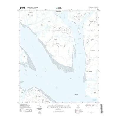
2014 Map of Parris Island
USGS Topo · Published 2014About this map
Parris Island and its surrounding tidal landscape are defined by a complex network of marshes, reaches, and sounds at the edge of the Atlantic Ocean. The military presence is evident through a grid of streets bearing names like Guantanamo St, Chosin Reservoir Rd, and Iwo Jima Rd, reflecting the mid-20th-century legacy of the Marine Corps Recruit Depot. To the east, across the Beaufort River, the community of Lands End and the grounds of Fort Fremont occupy the southern tip of Saint Helena Island. The map records the intricate waterways critical to the region's geography, from the Intracoastal Waterway and Port Royal Sound to smaller features like Archers Creek and Station Creek. Genealogists may find interest in the Elliot Cem located near Dolphin Head on Hilton Head Island, as well as the transition from established settlements like Port Royal to more isolated landforms such as Bay Point Island and Capers Island.
Find a feature on this map
96 named features on this map. Tap any name to fly to it.
Don’t see what you’re looking for? This feature index may not catch every label — zoom into the map to look around manually.
Map Details
Editions of this 2014 Parris Island Map
This is the sole edition of this map. No revisions or reprints were ever made.
Other maps of this area

1920 · Okatie
USGS Topo · 1:62,500

1920 · Hilton Head
USGS Topo · 1:62,500

1920 · Bluffton
USGS Topo · 1:62,500

1942 · Okatie
USGS Topo · 1:62,500

1944 · Fort Fremont
USGS Topo · 1:62,500

1945 · Bluffton
USGS Topo · 1:62,500

1945 · Hilton Head
USGS Topo · 1:62,500

1947 · Savannah
USGS Topo · 1:250,000

1948 · Savannah
USGS Topo · 1:250,000

1956 · Frogmore
USGS Topo · 1:24,000