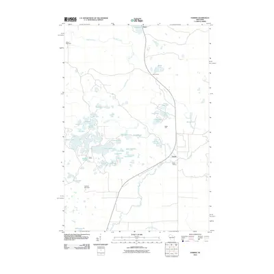
2010 Map of Parrish
USGS Topo · Published 2010About this map
Parrish is the primary settlement in this corner of Lincoln County, characterized by a dense concentration of glacial lakes and northern wetlands. This 2010 survey shows a landscape dominated by water and low relief, where small crossroads like Jeffris Junction and Paulson Junction once connected local traffic across a network of drainages including Big Pine Creek and Fish Creek. The map reveals a high density of named water bodies, from the sprawling Seven Island Lake and Chain Lake to the more isolated Little Pike Lake.
Find a feature on this map
42 named features on this map. Tap any name to fly to it.
Don’t see what you’re looking for? This feature index may not catch every label — zoom into the map to look around manually.
Map Details
Editions of this 2010 Parrish Map
This is the sole edition of this map. No revisions or reprints were ever made.
Other maps of this area

1939 · Cassian
USGS Topo · 1:48,000

1940 · Parrish
USGS Topo · 1:48,000

1940 · Rhinelander
USGS Topo · 1:48,000

1942 · Cassian
USGS Topo · 1:48,000

1949 · Rhinelander
USGS Topo · 1:48,000

1950 · Parrish
USGS Topo · 1:48,000

1950 · Tomahawk
USGS Topo · 1:48,000

1952 · Parrish
USGS Topo · 1:48,000

1952 · Tomahawk
USGS Topo · 1:48,000

1954 · Iron Mountain
USGS Topo · 1:250,000