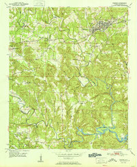
1951 Map of Parrish
USGS Topo · Published 1951About this map
Parrish serves as the industrial and residential anchor of this post-war landscape, where the Southern railroad connects small mining and timber communities. The town is flanked by Standard and America, reflecting the economic density of the Walker County coalfields during the mid-twentieth century. Away from the rail lines, the terrain is defined by the winding course of Lost Creek and Wolf Creek, where several landmarks like Kings Mill and Cain Store highlight the rural commerce that sustained local families.
Find a feature on this map
57 named features on this map. Tap any name to fly to it.
Don’t see what you’re looking for? This feature index may not catch every label — zoom into the map to look around manually.
Map Details
Editions of this 1951 Parrish Map
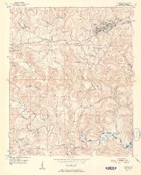
2 editions found
Other maps of this area

1893 · Jasper
USGS Topo · 1:125,000

1935 · Port Birmingham
USGS Topo · 1:48,000

1938 · Port Birmingham
USGS Topo · 1:62,500

1949 · Cordova
USGS Topo · 1:24,000

1949 · Parrish
USGS Topo · 1:24,000

1949 · Townley
USGS Topo · 1:24,000

1949 · Jasper
USGS Topo · 1:24,000

1949 · Oakman
USGS Topo · 1:24,000

1949 · Tutwiler School
USGS Topo · 1:24,000

1949 · Wiley
USGS Topo · 1:24,000