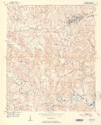
1951 Map of Parrish
USGS Topo · Published 1951About this map
Parrish serves as a central hub on this mid-century topographic survey, where the Southern railroad lines intersect to support a landscape defined by both agriculture and emerging industry. The presence of a Strip Mine near Standard and America highlights the coal-rich character of the Walker County terrain during the post-war years. Small communities and family-named points of interest such as Cain Store and Kings Mill are scattered throughout the hills, connected by winding roads that navigate the complex drainage patterns of Wolf Creek and Lost Creek.
Find a feature on this map
66 named features on this map. Tap any name to fly to it.
Don’t see what you’re looking for? This feature index may not catch every label — zoom into the map to look around manually.
Map Details
Editions of this 1951 Parrish Map
2 editions found
Other maps of this area

1893 · Jasper
USGS Topo · 1:125,000

1935 · Port Birmingham
USGS Topo · 1:48,000

1938 · Port Birmingham
USGS Topo · 1:62,500

1949 · Cordova
USGS Topo · 1:24,000

1949 · Parrish
USGS Topo · 1:24,000

1949 · Townley
USGS Topo · 1:24,000

1949 · Jasper
USGS Topo · 1:24,000

1949 · Oakman
USGS Topo · 1:24,000

1949 · Tutwiler School
USGS Topo · 1:24,000

1949 · Wiley
USGS Topo · 1:24,000