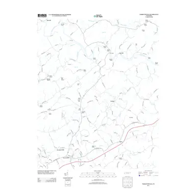
2013 Map of Parrottsville
USGS Topo · Published 2013About this map
Parrottsville serves as a focal point for this 2013 survey of the Tennessee landscape, positioned near the junction of several regional routes including Route 321. The settlement pattern reflects a deeply rooted community where family-named landmarks and geographic features dominate the terrain. To the north, the small community of Ottinger and the elevated point of Bird Hill provide local orientation points amidst a network of winding local roads and watercourses. This modern record by the U.S. Geological Survey captures the enduring spatial layout of eastern Tennessee, showing how contemporary infrastructure like Route 340 and Route 35 overlays the traditional settlement areas that have defined the region for generations.
Find a feature on this map
7 named features on this map. Tap any name to fly to it.
Don’t see what you’re looking for? This feature index may not catch every label — zoom into the map to look around manually.
Map Details
Editions of this 2013 Parrottsville Map
This is the sole edition of this map. No revisions or reprints were ever made.
Other maps of this area

1883 · Morristown
USGS Topo · 1:125,000

1892 · Greeneville
USGS Topo · 1:125,000

1893 · Mt Guyot
USGS Topo · 1:125,000

1893 · Morristown
USGS Topo · 1:125,000

1894 · Asheville
USGS Topo · 1:125,000

1895 · Morristown
USGS Topo · 1:125,000

1896 · Greeneville
USGS Topo · 1:125,000

1901 · Asheville
USGS Topo · 1:125,000

1904 · Greeneville
USGS Topo · 1:125,000

1912 · Mt Guyot
USGS Topo · 1:125,000