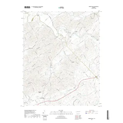
2019 Map of Parrottsville
USGS Topo · Published 2019About this map
The Nolichucky River winds through this section of Cocke and Greene counties, creating a landscape defined by sharp ridges and complex drainage systems. Near the town of Parrottsville, the presence of Brookside Mill on Clear Cr suggests a legacy of local water-powered industry, while the nearby Salem community and Ottinger area reflect the agricultural settlement patterns of East Tennessee. Significant genealogical markers are scattered throughout the hills, including the Harneds Chapel Graveyard and Ottinger Cem.
Find a feature on this map
128 named features on this map. Tap any name to fly to it.
Don’t see what you’re looking for? This feature index may not catch every label — zoom into the map to look around manually.
Map Details
Editions of this 2019 Parrottsville Map
This is the sole edition of this map. No revisions or reprints were ever made.
Other maps of this area

1883 · Morristown
USGS Topo · 1:125,000

1892 · Greeneville
USGS Topo · 1:125,000

1893 · Mt Guyot
USGS Topo · 1:125,000

1893 · Morristown
USGS Topo · 1:125,000

1894 · Asheville
USGS Topo · 1:125,000

1895 · Morristown
USGS Topo · 1:125,000

1896 · Greeneville
USGS Topo · 1:125,000

1901 · Asheville
USGS Topo · 1:125,000

1904 · Greeneville
USGS Topo · 1:125,000

1912 · Mt Guyot
USGS Topo · 1:125,000