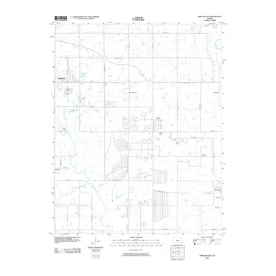
2010 Map of Parsons East
USGS Topo · Published 2010About this map
Parsons anchors the western edge of this landscape, where the street grid of residential neighborhoods meets the expansive section lines of Labette County. The terrain is defined by the winding course of Labette Creek and its tributaries, Little Labette Creek and Bachelor Creek, which carve through the farmland before the watershed reaches the Neosho River in the northeast. This 2010 survey captures a mix of small rural communities and significant genealogical landmarks, including Montana and Brownstone. The distribution of burial grounds across the quadrangle, from the Masonic Cemetery in the southeast to Oakwood Cemetery near the city center, reflects the long-standing settlement patterns of the region. The map also details a transition from the urban streets of Parsons, like Leawood Ave and Hazel Ave, to a rigorous network of numbered county roads that facilitate the agricultural economy of the Kansas plains.
Find a feature on this map
40 named features on this map. Tap any name to fly to it.
Don’t see what you’re looking for? This feature index may not catch every label — zoom into the map to look around manually.
Map Details
Editions of this 2010 Parsons East Map
This is the sole edition of this map. No revisions or reprints were ever made.
Other maps of this area

1886 · Parsons
USGS Topo · 1:125,000

1893 · Parsons
USGS Topo · 1:125,000

1943 · McCune
USGS Topo · 1:62,500

1944 · Oswego
USGS Topo · 1:62,500

1945 · Mc Cune
USGS Topo · 1:62,500

1945 · Parsons
USGS Topo · 1:62,500

1946 · Oswego
USGS Topo · 1:48,000

1946 · Parsons
USGS Topo · 1:62,500

1946 · Mound Valley
USGS Topo · 1:62,500

1947 · Parsons
USGS Topo · 1:62,500