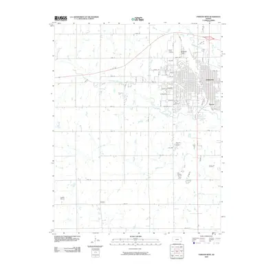
2009 Map of Parsons West
USGS Topo · Published 2009About this map
Parsons anchors the eastern edge of this Labette County landscape, revealing a well-defined grid of residential and commercial streets. The city's northern outskirts are marked by Mount Calvary Cemetery and the recreational space of Orchard Park, while the settlement of Winway appears to the southeast. The surrounding terrain is defined by a series of drainage systems, including Labette Creek and Little Labette Creek, which meander through a patchwork of agricultural sections. To the west, the landscape becomes increasingly rural, punctuated by the distinct elevation of Tackett Mound. Genealogists will find several notable burial sites throughout the quadrangle, from the Memorial Lawn Cemetery near the city to the more remote Wilsonton Cemetery and Spring Hill Cemetery. The infrastructure reflects a blend of modern transport and historical routes, with Us HWY 400 cutting across the northern reaches and Katy Dr referencing the area's rail heritage.
Find a feature on this map
61 named features on this map. Tap any name to fly to it.
Don’t see what you’re looking for? This feature index may not catch every label — zoom into the map to look around manually.
Map Details
Editions of this 2009 Parsons West Map
This is the sole edition of this map. No revisions or reprints were ever made.
Other maps of this area

1886 · Parsons
USGS Topo · 1:125,000

1893 · Parsons
USGS Topo · 1:125,000

1943 · McCune
USGS Topo · 1:62,500

1944 · Oswego
USGS Topo · 1:62,500

1945 · Mc Cune
USGS Topo · 1:62,500

1945 · Parsons
USGS Topo · 1:62,500

1946 · Oswego
USGS Topo · 1:48,000

1946 · Parsons
USGS Topo · 1:62,500

1946 · Mound Valley
USGS Topo · 1:62,500

1947 · Parsons
USGS Topo · 1:62,500