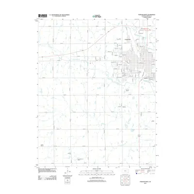
2012 Map of Parsons West
USGS Topo · Published 2012About this map
The western portions of Parsons, Kansas, are defined by a rhythmic grid of residential streets and educational facilities such as the Labette Community Coll. To the west, the landscape transitions into agricultural sections partitioned by a network of rural roads like Jackson Rd and Kiowa Rd. This area is drained by a series of waterways, including Little Labette Cr and Bachelor Cr, which meander through the prairie landscape. Several local cemeteries, including Mount Calvary Cem and Wilsonton Cem, are situated on the outskirts of the town, providing valuable landmarks for genealogical research. Aviation history is represented by both Blue Sky Airport and the Reed-Wilsonton Airport south of town. The distinctive elevation of Tackett Mound rises in the southwest, offering a prominent natural feature amidst the surrounding fields and creek beds.
Find a feature on this map
84 named features on this map. Tap any name to fly to it.
Don’t see what you’re looking for? This feature index may not catch every label — zoom into the map to look around manually.
Map Details
Editions of this 2012 Parsons West Map
This is the sole edition of this map. No revisions or reprints were ever made.
Other maps of this area

1886 · Parsons
USGS Topo · 1:125,000

1893 · Parsons
USGS Topo · 1:125,000

1943 · McCune
USGS Topo · 1:62,500

1944 · Oswego
USGS Topo · 1:62,500

1945 · Mc Cune
USGS Topo · 1:62,500

1945 · Parsons
USGS Topo · 1:62,500

1946 · Oswego
USGS Topo · 1:48,000

1946 · Parsons
USGS Topo · 1:62,500

1946 · Mound Valley
USGS Topo · 1:62,500

1947 · Parsons
USGS Topo · 1:62,500